A trail can be described as “five miles, moderate” and still be five entirely different days. Five miles out and back is not five miles each way. A thousand feet of climbing spread across a long approach is not the same as a thousand feet in the final mile. A maintained path and a loose boulder field can share a distance and very little else.
Treat the description as a set of fields, not a verdict. “Moderate” is the least portable part. Distance, gain, route shape, surface, exposure, navigation, season, and current conditions tell you what the trip will actually ask.
First, draw the route with one line
Is it an out-and-back, loop, point-to-point, or lollipop? Confirm whether the listed distance is total or one way. Mark the trailhead, destination, junctions, turnaround point, and any alternate exit. A point-to-point route also needs transportation at the far end; a loop does not guarantee that the hardest climb is behind you at halfway.
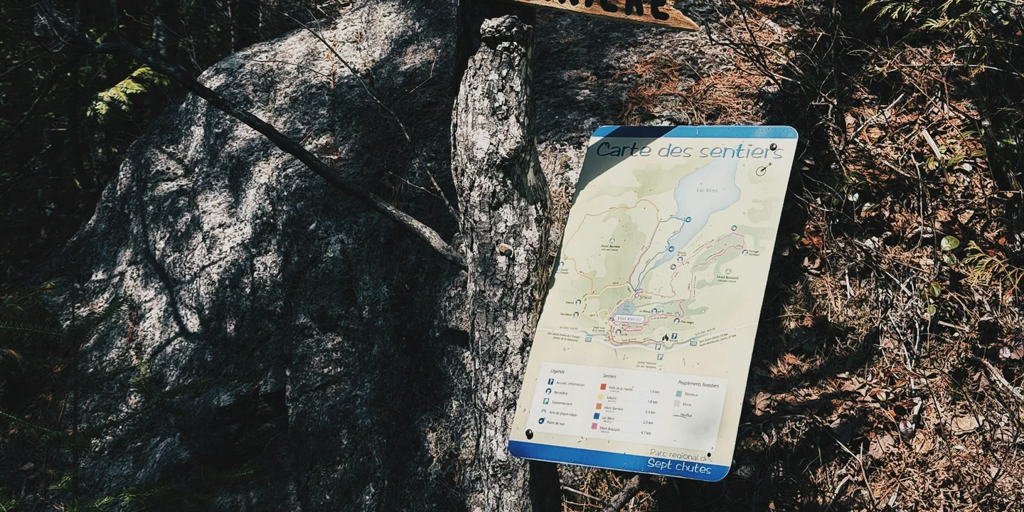
Open the official map rather than relying on the description alone. Match trail names and junctions, note seasonal closures, and look for water crossings, road walks, or places where several paths share a name. Save the map offline and carry the backup appropriate to the trip.
Distance and gain need a shape
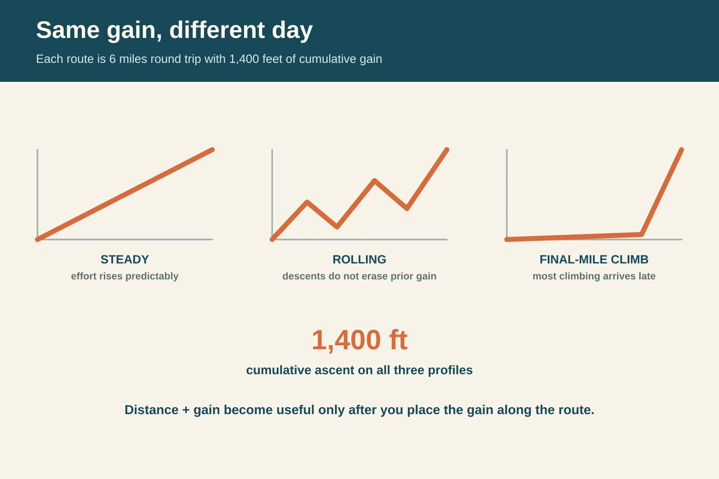
Six miles and 1,400 feet of gain can mean a steady climb, repeated rollers, or a flat approach followed by a steep final mile. The totals are identical; pacing, water use, and the turnaround decision are not.
Trace the profile left to right. Mark where climbing begins, where descent must be reclimbed, and whether the hardest segment arrives after the group is tired.
Surface changes the meaning of a mile
Look for words such as paved, packed dirt, roots, loose rock, sand, talus, mud, snow, boardwalk, steps, scramble, and ford. They describe movement, footwear, and attention. “Unmaintained” may mean brush, fallen trees, eroded tread, or route-finding; find the official route or campground page's definition rather than supplying your own.
Exposure is separate from steepness. A broad steep trail can feel manageable to someone who dislikes heights, while a nearly level ledge can stop them completely. Search the official description for drop-offs, ladders, narrow sections, stream crossings, and seasonal ice.
Read current conditions as part of the route
A trail description is the durable skeleton. Alerts, closures, weather, fire restrictions, snow, water levels, and road access are the live layer. Check the managing agency close to departure and again when practical. A bridge outage or closed access road can change the route without changing its published mileage.
Recent public reports can add texture, but they do not override the official route or campground page or prove that a condition remains the same. Note the date, direction of travel, and whether the report describes the exact route. “Clear last weekend” is not a permit, forecast, or bridge inspection.
Also confirm reliable water and its seasonality, permit or quota requirements, trailhead parking capacity and fees, gate hours, shuttle timing, and whether the access road suits the vehicle. Each can end a trip before the first mile.
Make a go, turn, and return plan
Write a start time, conservative turnaround time, and latest comfortable return. Name the place where you will reassess—perhaps a junction before the steep section. Decide what weather, water, pace, or group condition causes a turn. A turnaround is easier when it was part of the plan before anybody became invested in the destination.
Finally, say the route out loud in plain language: “Three miles to the lake, most climbing in the second mile, loose descent on the return, no reliable water after the bridge, back at the car before six.” If the group understands that sentence, the trail description has done its job.
Look up sunset and civil twilight for the route's date and location, then build in headlamp and delay margin. “Back before dark” is not a time until the date, terrain, and group pace are attached to it.
Sources and further reading
Image credits
Lead image: Amir Shahcheraghian / Unsplash · Unsplash License.